
Why Chandigarh looks the way it does
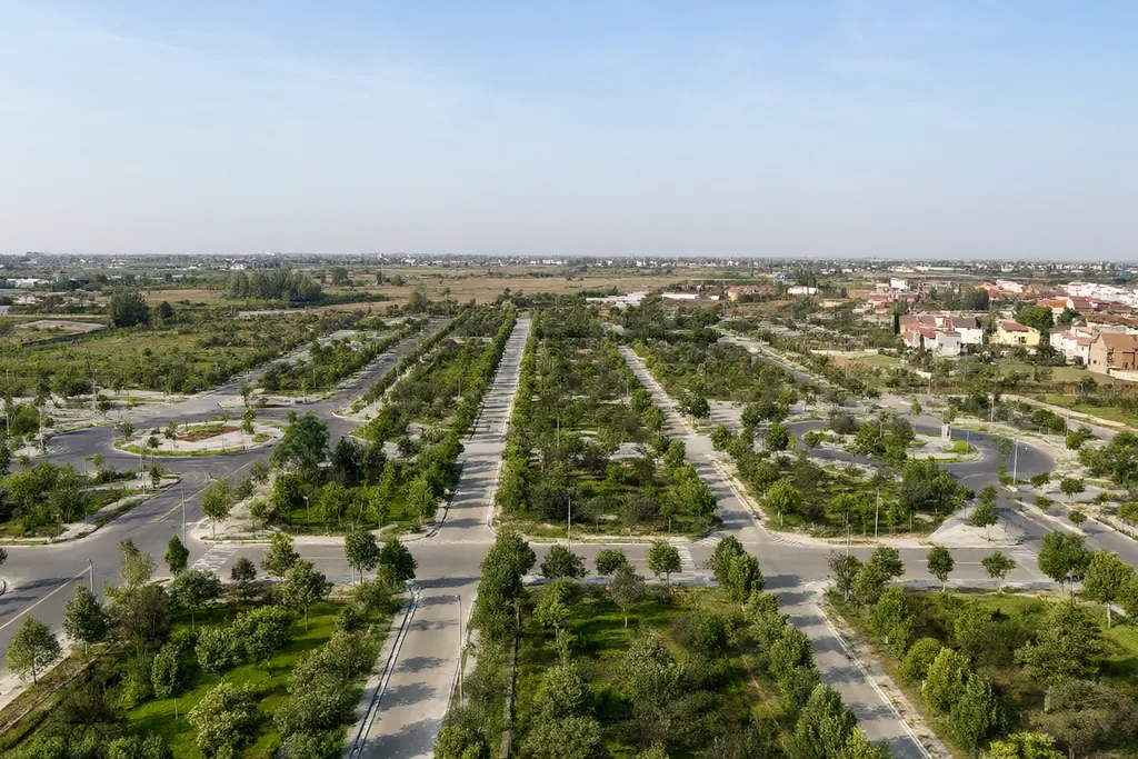
Chandigarh is unusual among Indian cities in that it was designed as a whole before it was built. A single master plan set out where the roads would run, how neighbourhoods would be sized and how much land would be kept open, and that plan still governs much of what a visitor notices today. Understanding the idea behind the layout explains the wide roads, the repeated neighbourhoods and the calm that visitors find hard to place.
This explainer describes the planning principles in general terms. It avoids figures for area or population and does not attempt to catalogue individual buildings, because the useful thing to understand is the structure itself and why it has proved so durable.
A city designed as one idea
Most cities grow piece by piece, each extension reacting to the last. Chandigarh was the opposite: the overall shape was decided first, and the parts were then fitted into it. That order of work produces a very different result. Roads can be laid out in a hierarchy before traffic exists, open land can be reserved before it is valuable, and public buildings can be placed where they will serve the whole city rather than whoever happens to be nearby. The plan is the reason the city feels coherent rather than accumulated.
The road hierarchy
The plan sorts movement into clear levels, from fast arterial roads that carry traffic between distant parts of the city down to quiet streets inside residential neighbourhoods. Each level is meant to do one job. Fast roads are kept away from homes; local streets are not asked to carry through traffic. This division is what makes it possible to cross the city quickly while living on a street where children can walk. When the hierarchy is respected, the city works; when a fast road starts to function as a local street, the logic begins to fray.
Neighbourhoods as repeated units
Rather than expanding outward in an irregular way, the plan repeats recognisable units, each with its own shops, school, health post and open space. Repetition of this kind is efficient: the same needs are met by the same arrangement everywhere, and residents do not have to travel far for daily requirements. It also means that the city can be read, because a visitor who has understood one unit has understood the principle behind all of them.
Green space as structure, not decoration
In Chandigarh, open land is part of the framework rather than whatever is left over after building. Green belts run between neighbourhoods, and larger leisure areas are threaded through the city, so that vegetation is encountered on ordinary journeys rather than only at a destination. This has practical effects: it moderates heat, absorbs water, provides walking routes and gives the city a continuous landscape. It is also generous in a way that was deliberate, not accidental.
Why the plan still matters
A plan is only useful if it constrains later decisions, and this is where Chandigarh becomes interesting. Pressure to change land use, to build higher or to convert open space into something else is permanent, and the plan is what any such proposal must argue against. Every generation inherits the same question: how much of the original idea should be preserved, and where can it sensibly be adapted. The fact that the question is still asked is itself evidence of how strong the founding idea was.
Principles you can see on an ordinary walk
- Main roads are separated from the streets where people live.
- Each neighbourhood contains the shops and services needed daily.
- Open land is planned into the layout rather than left over afterwards.
- Trees and green belts appear along ordinary routes, not only in parks.
- Public buildings are sited to serve the city as a whole.
The plan's main elements
| Element | What it does | Why it was chosen |
|---|---|---|
| Master plan | Fixes the overall shape before construction | Prevents the city from growing reactively |
| Road hierarchy | Separates fast and local movement | Keeps through traffic away from homes |
| Repeated neighbourhoods | Meet daily needs close to where people live | Efficiency and legibility |
| Green belts | Thread open land through the city | Climate, drainage, walking and landscape |
| Reserved public sites | Place civic buildings for the whole city | Access for everyone, not just neighbours |
The value of one clear idea
Chandigarh is best understood not as a collection of handsome buildings but as a single planning argument carried out at the scale of a city. The wide roads, repeated neighbourhoods and continuous green space are all consequences of that argument. Whether the city keeps the character it was designed for depends on the choices made about land use in each generation, which is why the plan remains a live document rather than a piece of history.
Read next
How the sector system works
Numbering, addresses and orientation: reading Chandigarh's layout without a map.
Green space: the city's quiet infrastructure
Leisure valleys, gardens and tree-lined avenues, and why they matter more than decoration.
Modern architecture and the city's heritage
What makes the buildings here distinctive and how that heritage is looked after.